Please Contact us to discuss a trip: +44 (0)131 214 1144 (Edinburgh, UK)

Alta Via 2: North

7 stages . 8 nights . Italian Dolomites

Key Information

  • Grade: Black 4
  • Start: Brixen (Bressanone)
  • End: Passo San Pellegrino
  • Season dates: 14 July to 18 Sept 2025
  • Length: 7 days' walking
  • Typical walk: 14km, 900m ascent
  • Total distance: 96km or 60 miles
  • Highest altitude: 2,908m
  • Group size: 2 or more trekkers
From GBP 1,380 per person
Book Now

The Alta Via 2, also known as the ‘Way of the Legends’ (Alta Via delle Legende) is one of the most spectacular of the Alta Viae, a series of hut-to-hut trails criss-crossing the Dolomites of Northern Italy. This region of the Alps is famous for its almost impossibly sheer-sided rocky peaks and vast limestone plateaus, dotted with welcoming mountain huts offering delicious food and a warm communal atmosphere typical of Northern Italian hospitality.

The Alta Via 2 crosses several of the major ranges of the Dolomites, passing through the Puez-Odle nature park, breaching the sheer rocky walls of the Sella group and circumnavigating the Marmolada, the highest peak of the Dolomites and the site of the only significant glacier in the area. Compared to its famous neighbour, the Alta Via 1, the Alta Via 2 is notably more challenging; the days are longer, the elevations higher, and the full trail includes several sections of secured climbing routes known as Via Ferrata. The technical difficulty of the Southern half of the route cannot be understated and as such, we offer only the Northern half of the route; this makes for a well-rounded, albeit challenging, 7-stage trip, sticking to hiking terrain throughout.

Our routecards follow the main Alta Via 2 trail from Brixen (Bressanone) in the North to Passo San Pellegrino in the South, walking every step of the way over 7 days. We detour briefly from the official route around Passo Gardena to avoid unduly technical ground around Rifugio Pisciadu, hiking instead via Passo Sella to allow you to walk some of the best sections of the Alta Via 2 without any Via Ferrata. The Alta Via 2 is overall one of the most spectacular trails in the Alps, and our Alta Via 2: North trip makes for an unforgettable week of walking in a truly beautiful area.

Latest news January 2025:  We are now taking bookings for Summer 2025!

Map

Trip Information

Slide 1

Arrival day: Arrive in Brixen (Bressanone)
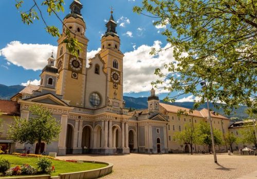
Your trips starts on arrival in Brixen (Bressanone), a delightful small town in Italy’s German-speaking Südtirol region (hence the two names!) located on the main train line between Verona and Innsbruck. It’s worth taking an afternoon to explore the cobbled streets and ornate town square before preparing to start your hike!
Hotel in Brixen (breakfast)

Slide 1

Stage 1: Brixen to Rifugio Plose

Red 4

11.6km with 1890m ascent, 10m descent
Walked in full, this stage is far from a gentle introduction to the route! Leaving the delights of Brixen behind, we climb to the hillside village of San Andrea before a long, sustained ascent through the forested slopes of the Plose massif, a famous ski area in winter (providing a handy cable car option to shorten today’s ascent, if desired). A final stretch in more open ground gives spectacular panoramic views, both of the Dolomites but also further afield to the glaciated peaks of Austria and Switzerland. Arrive at the friendly, well-appointed Rifugio Plose for your first night in the mountains.<br>
Mountain hut (2446m) (dinner and breakfast)

Slide 1

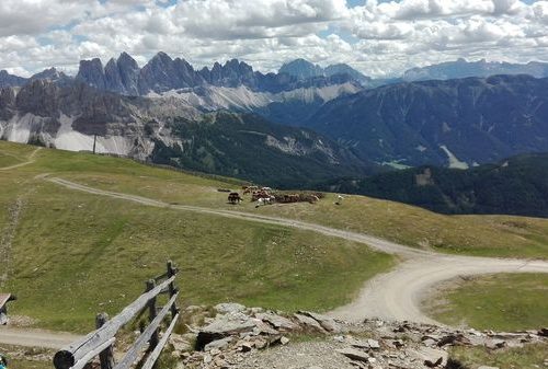
Stage 2: Rifugio Plose to Rifugio Genova
<b class=”badge-red-new”>Red 3</b> 13.3km with 580m ascent, 730m descent
A (likely welcome!) gentler stage today, starting with a gentle descent from the Plose hut through meadows to the wooded Passo Rodella. From here, we climb back into the mountains beneath the imposing flanks of the Peitlerkofel, crossing the dramatic Forcella del Pütia before a short traverse to reach the Rifugio Genova.
Mountain hut (2306m) (breakfast)

Slide 1

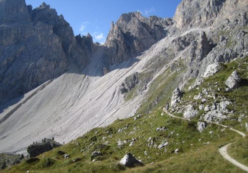
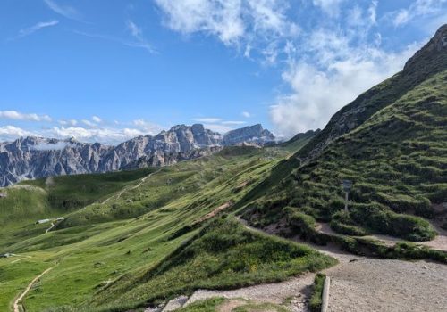
Stage 3: Rifugio Genova to Rifugio Puez
<b class=”badge-black-new”>Black 3</b> (grade) 11.4km with 760m ascent, 580m descent
The most dramatic stage yet, today’s hike crosses a series of steep, rocky cols with the best scenery so far, passing through the heart of the Puez-Odle group with spectacular views down the valley to the famous peak of the Seceda. A steep scree descent and an exposed section with a short cable handrail provide an enjoyable challenge, before the gradient eases as you cross the high plateau of the Puez massif. Arrive at the remote, family-run Rifugio Puez.
Mountain hut (2475m) (dinner and breakfast)