Please Contact us to discuss a trip: +44 (0)131 214 1144 (Edinburgh, UK)

Walking in the UK

WALKING GUIDE

Walking in the UK: An introduction

 Walking guides – see all our background pages

The basics

This page is aimed at overseas visitors who are getting to know the outdoor way of life in the UK.

A brief note about names: walking is the British term for hiking, tramping or any other words for putting one foot in front of the other in the outdoors. Rambling is the term for gentler walks through flatter countryside. Hillwalking or mountain walking mean walking, as opposed to rock climbing, up hills and mountains. Trekking and backpacking are used fairly interchangeably, but backpacking suggests carrying your camping gear on your back.

Brits don’t have an equivalent to the term through-hiking, re. long-distance paths – they’d just say they were doing the whole thing.

Our UK walking holidays

Self-guided walking
 Affric Kintail Way
 Hebridean Way
 Lake District Tour
 Snowdonia Way
 West Highland Way

Best bits

For the highest and rockiest mountains
Head to the Highlands! The Scottish Highlands contain by far the biggest expanse of mountainous terrain in the UK. Ben Nevis at 1,344m (4,409ft) is the highest mountain in the British Isles; with its huge North face cliffs and the sharp ridge to neighbouring Carn Mor Dearg, it certainly lives up to this status. On the Isle of Skye the Cuillin ridge is justly famous as the most jagged range in the country. Back on the mainland check out the Glen Coe peaks, the area around Glen Shiel, the Arrochar Alps and the Galloway Hills.

Outside Scotland, the highest mountains of England and Wales are also very worthwhile rocky peaks. Scafell Pike at 978m (3,209ft) offers several long approaches from nearby valleys, which Snowdon at 1,085m (3,560ft) is a mountain of many radiating ridges enclosing deep combes.

For coastal views of cliffs and sea
Being an island, the British mainland is not short of coastal views. It so happens that many parts of our coast are exciting walking territory in their own right. Cornwall is perhaps the best known coastal walking destination with miles of footpath skirting the edge of cliffs. Look out for quiet sandy beaches below. The Pembrokeshire coast at the South West tip of Wales is less well known but arguably just as spectacular. For sea views mixed with wild rocky landscapes, the Western Highlands and the areas of Assynt and Sutherland in the far North of Scotland are incomparable. Getting across to the islands (Skye, Rum, Harris…) adds another perspective to this amazing experience.

For idyllic lower-level walks
It’s difficult to look beyond the Southern Lake District for the best rambling country. The scenery is captivatingly beautiful and yet tranquil at the same time. The density and quality of the footpaths make this area very easy to walk through. Link up valleys such as Great Langdale, Little Langdale or Yewdale; walk from idyllic villages such as Elterwater, Hawkshead or Satterthwaite; or explore beyond the lakes and tarns such as Tarn Hows, Blea Tarn and Coniston Water. This country is also easily reached by bus from Ambleside.

For low-level walks the Yorkshire Dales and the Peak District also have many excellent spots. Easier walks can of course be made in even the harshest and highest mountainous areas, and on this note the Highlands, Snowdonia and higher Lakeland hills are great places to go.

City breaks after trekking

Our holidays come with notes on relevant cities, in your info pack:

HBW Hebridean Way
 Glasgow in Scotland * Usual start/end
 Edinburgh in Scotland

LDT Lake District Tour
 Manchester in England * Usual start/end

PEW Pennine Way
 Manchester in England * Usual start/end
 Edinburgh in Scotland

WHW West Highland Way
 Glasgow in Scotland * Usual start/end
 Edinburgh in Scotland

 City breaks after trekking

Such low hills – where’s the challenge?

Overseas visitors could be forgiven for thinking the UK’s mountains are just low easy hills – at a maximum of 1,344m (4,409ft) and often between 600m and 1,000m, the hills certainly are very low compared to the Alps, Pyrenees, Tatras and of course the Rockies and Himalayas. The highest point in the British Isles would even fit underneath many of the valleys surrounding Mont Blanc! Despite this the wilder mountain ranges in the UK can present a real challenge to the uninitiated, due to three main reasons:

Lack of paths
Climbing a given mountain in the UK, walkers can’t expect to follow a footpath all the way. Popular mountains usually have footpaths up and down, but on the rest you should expect to go cross-country at least part of the way. This is a very different situation from the Alps where walkers pick their paths from the network of footpaths available. Mountains in the UK are largely clear of trees on their upper slopes, leaving bare grassy and rocky hillsides that let walkers (with care) find their own way, subject to any restrictions on access.

Wild weather
British weather is less settled than in the Alps. A typical summer week could be full of sunshine but more likely will be a frequently changing mix of sun, rain and wind.

Lack of signs
The outdoor culture in the UK is one of self-reliance in wild areas. Signposts have never become prevalent in the hills and mountains, even on popular peaks such as Snowdon or Helvellyn. There are also no waymarks to be found, which might surprise people used to walking in the Alps where painted lines and dots often mark the way. Instead the way forward is to take a map compass and (crucially) the skills to use them in mist. In the valleys the situation is different. Here, it is usual to find signposts showing the route of paths across fields and down tracks.

Long-distance paths

Introduction
The UK has a good range of long-distance paths, or trails. The best known are possibly the Pennine Way (429km or 268 miles) running the length of the Pennine chain from Derbyshire to the Scottish border, the West Highland Way (152km or 95 miles) running from Glasgow to Fort William through the Southern Highlands, and the Coast to Coast (307km or 192 miles) initiated by the famous fellwalker Wainwright and running from St Bees to Robin Hood’s Bay across three of England’s national parks: the Lake District, the Yorkshire Dales and the North York Moors.

In Scotland we also cover the Hebridean Way, a 250km (156 miles) trail running up the chain of the Outer Hebrides, and the Affric Kintail Way which is a 71km (44 miles) valley trail through the picturesque Glen Affric. In England we offer the Lake District Tour, a 99.5km (62.5 miles) circular route, and in Wales our newest trip is the Snowdonia Way which is 156km (97 miles).

For other ideas, try the following:

Pembrokeshire Coast Path: 300km (186m) coastal trail round Wales’ beautiful South West tip – beaches galore
Cleveland Way: 177km (110m) North York Moors exploration from Helmsley to Filey via Osmotherley and Whitby
Offa’s Dyke: 285km (177m) South to North trail through Wales along the big earthwork of 8th century king Offa
Glyndwr’s Way: 213km (132m) trail making a loop with Offa’s Dyke into Wales, visiting Machynlleth and Llanidloes
South West Coast Path: 1,014km (630m) epic around the coastline of Cornwall, Devon, Dorest and Somerset
Southern Upland Way: 340km (212m) coast to coast path across the wild and remote hills of Southern Scotland
Wainwright Memorial Walk: 163km (102m) giving views of every lake, valley and mountain in the Lake District

Trails versus centre-based holidays
Following a trail is one of the most enjoyable ways to walk in Britain. As each day progresses you are ticking off sections of a set route, which can be very satisfying. There is the anticipation of trail highlights yet to come. As you walk along, sections that you have been anticipating become part of your experience instead of just pictures in a book.

It can be tricky to compare a trail to a centre-based holiday. There are benefits and disadvantages to both. Based in one place, practicalities are sometimes easier and you can get to know the area well; on a trail the process of moving on each day can initially be unsettling but should (with any luck) become a large part of the enjoyment in itself. Life becomes simple with just the trail to think about.

Where to stay

Accommodation for walkers in the UK is as varied as in other countries, with the exception of mountain huts. With the shorter walk-ins there has never been a move to build huts in the mountains. The network of youth hostels and bunkhouses in the valleys is however extremely good, and of course bed and breakfast accommodation in local houses, hotels and farms is abundant.

The outdoor culture is very well ingrained in rural life, with several centres being particularly well attuned to the needs of walkers – for example, Keswick, Ambleside, Fort William, Aviemore, Llanberis and Betws-y-coed. Smaller villages and towns in the same areas also invariably have accommodation and facilities.

Walk in Britain with Alpine Exploratory

Alpine Exploratory offers a number of self-guided walking holidays in the British mountains. Our holidays set you up for a successful trip under your own steam. We arrange your accommodation, whether this is entirely in one place or along the length of a long-distance path. We send you our well-received info packs including routecards, the maps, emergency cards with essential info for accidents, and notes on transport.

The route

Glasgow city centre to Milngavie (optional)
The link path from Glasgow city centre to the official start of the WHW in Milngavie makes a fascinating half-day or short whole day’s walk. Contrary to what you might think, the walking is not along main roads and through residential streets, but instead follows a riverside path for much of the way. Starting from Glasgow Central station the River Clyde is followed initially. Later reach Kelvingrove Park in the West End and follow the River Kelvin through the city to the outskirts. Now in open fields, switch to the Allander Water and follow this into the self-contained and prosperous suburb of Milngavie.

Milngavie to Drymen
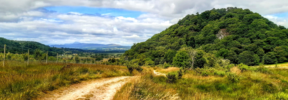
The official start point of the West Highland Way is in the central street of Milngavie near shops, bakeries and banks. Within 100 metres’ walk you are on a path heading into Mugdock Country Park where gentle walking among trees takes you to more open country. Pass Craigallian Loch on a wide track, then Carbeth Loch, coming to a sudden wide panorama of your route ahead. Drop down into the valley in the shadow of Dumgoyne in the Campsie Fells. On a long flat section along the old railway line pass Glengoyne Distillery and later reach the road at the hamlet of Gartness. Along lanes come to the pretty and practical village of Drymen with its neat central green.

Drymen to Rowardennan
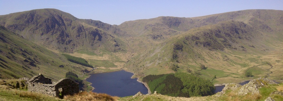
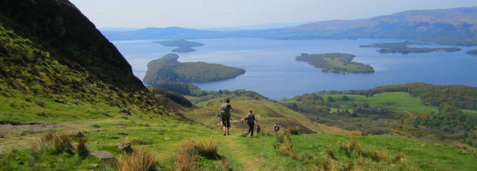
Set off from Drymen for Conic Hill, at 361m the highest point in the Southern half of the Way. After easy tracks through Garadhban Forest arrive at the foot of Conic Hill and ascend to its summit for great views. Loch Lomond is now well seen. The route drops down steeply to the small village of Balmaha on the shores of Loch Lomond. The second half of today’s stage follows the shoreline of the loch, diverting a few times and climbing up and down over small rises. Views are excellent. Reach the hamlet of Rowardennan and enjoy the view North down the loch from the striking war memorial, a circle of stone containing a pyramid.


Rowardennan to Inverarnan
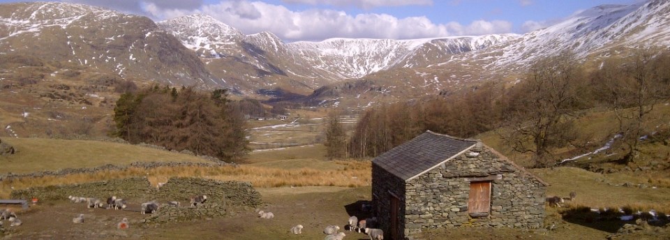
Forest tracks continue the route North from Rowardennan and rise gently high above the loch shore. Later the track ends and a winding, undulating footpath in trees brings you back to the water and to Inversnaid. See across the loch at this point to the group of mountains known as the Arrochar Alps. Carry on from Inversnaid, past Rob Roy’s Cave. More lochside walking leads to an ascent past the small hill of Cnap Mor at the head of the loch. Finally reach Inverarnan beyond fields and across the River Falloch.

Inverarnan to Tyndrum
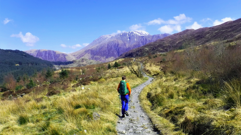
Today’s stage is out in the open for large stretches and takes at last to the high mountain scenery. Inverarnan is the gateway to Glen Falloch. Follow the glen on easy tracks with the West Highland Line’s trains passing by occasionally. The village of Crianlarich is reached through woods slightly off the main route before taking again to the woods in Strathfillan. Tyndrum is ahead and has lots of facilities for the walker. More beautiful villages are yet to come but here is a great place to relax and restock. You might well have time to walk the easy section to Bridge of Orchy this afternoon.

Tyndrum to Kingshouse
The majestic sight of Beinn Dorain, a cone in appearance from the South, is a highlight of this stage. Leaving the staging post of Tyndrum there is a sense of setting off into new mountainous country. Bridge of Orchy is reached along tracks before the Way takes to the woods again for the short crossing to Inveroran. After this last bit of civilisation it’s time to tackle Rannoch Moor. Your route skirts the edge of this massive tract of moor, studded with lochans and bogs. At points there is no civilisation to be seen. End the day by dropping down to Kingshouse, an isolated spot on the edge of the Moor.

Kingshouse to Kinlochleven
From Kingshouse set off for what will be the West Highland Way’s highest stage. First pass along the valley floor and under the huge cliffs of Buachaille Etive Mor, a mountain familiar from countless postcards. Climb up the Devil’s Staircase, actually quite a simple path, to a surprising view of the country ahead. See down to Blackwater Reservoir and across to the Mamores and Ben Nevis. Now it’s time to descend on a long twisting track to Kinlochleven, the village at the head of Loch Leven which makes an ideal stop for the night.

Kinlochleven to Fort William
The final stage leaves the shelter of Kinlochleven to climb through woods to reach a high valley. Follow the valley on a track with the Mamores to your right. Drop down to Glen Nevis through forest, arriving near the foot of Ben Nevis having seen the huge bulk of its Western slopes from your trail. Easy valley walking then brings you to the centre of Fort William and the end of your quest. Well done!

Hike the West Highland Way with Alpine Exploratory

Alpine Exploratory offers a self-guided walking holiday along the whole West Highland Way.

 West Highland Way

Our self-guided holidays set you up for a successful trek under your own steam. We book and pay for your accommodation along the whole route; and we send you our well-received info packs including routecards for all the walking, the maps, emergency cards with essential info for accidents, and detailed notes about the local transport. We specialise in tailor-made arrangements, so if you fancy doing the Way in a super-fast time or over a leisurely fortnight, or if you’d like to add on the link path from the centre of Glasgow to Milngavie, let us know and we’ll fit your trip to suit you.

Please ask us any time for more details. Please feel free to describe your walking experience and preferences, and we’ll suggest which trek you might enjoy most.

Keep up with us on Facebook, Instagram, and our Blog for photos and updates from our own travels and clients’ trips.